SMART HORIZONS at ACAG9: ADMiR-led Workshop Charts Practical Path for AI-Driven Multi-Hazard Resilience in the Arab Region
2025-10-15
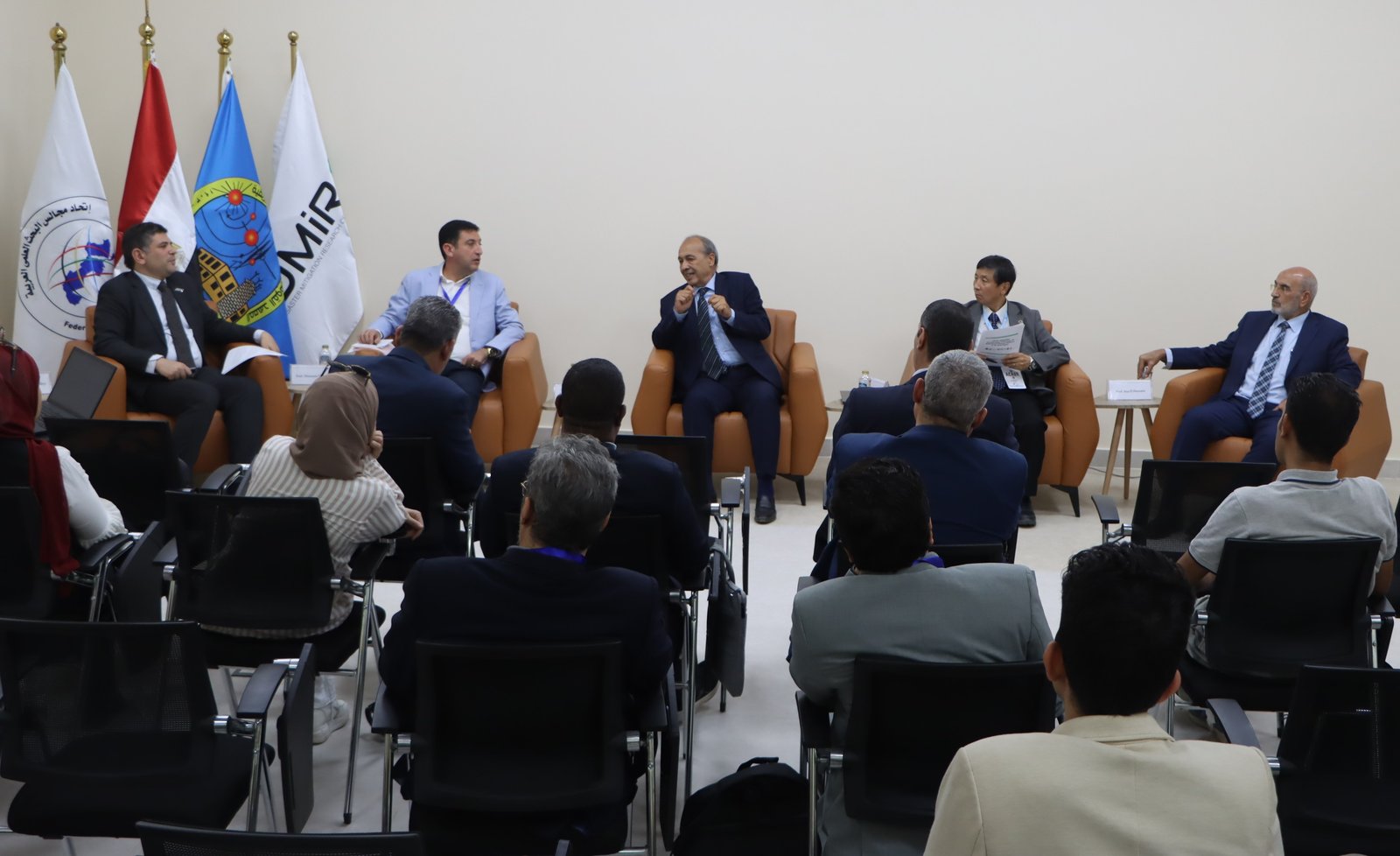
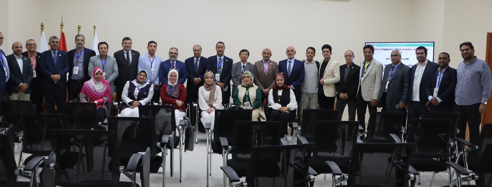
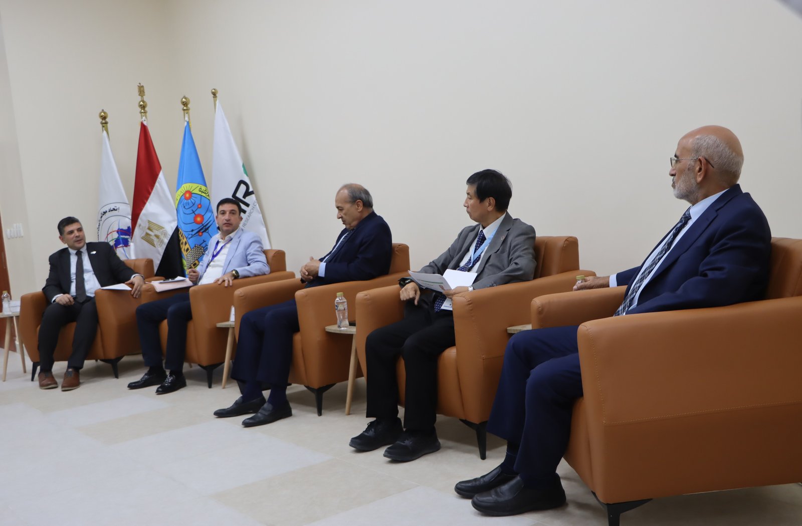
Cairo — 15 October 2025— The African Disaster Mitigation Research Center (ADMiR) hosted an extended workshop and panel at the Arab Conference on Astronomy & Geophysics (ACAG9) under the ARICA initiative (ARICA23_714: Enhancing Disaster Resilience in Arab Countries through Multi-Hazards Modelling and Mapping Using Machine Learning and IoT Sensors). The session—titled “SMART HORIZONS: AI & Emerging Technologies for Multi-Hazard Disaster Resilience in the Arab Region”—brought together regional and international experts to translate AI/ML, GeoAI, IoT sensing, VR/AR, and advanced monitoring into field-ready solutions that save lives and protect infrastructure.
Why it matters
Across the Arab region, fast-moving hazards—earthquakes, tsunamis, flash floods, dust/sand storms, and cascading risks—are intensifying alongside rapid urban growth. The workshop focused on how to compress time-to-alert, increase the trustworthiness of warnings, and embed analytics into building codes, operations, and everyday preparedness—with full respect for cultural and social context.
Program highlights
Keynote — Next-Generation Sensing & Simulation
Dr. Yoshiyuki Kaneda outlined how dense real-time networks (including offshore arrays and fiber-optic DAS/DOFS), combined with high-performance simulation, enable faster and more reliable earthquake–tsunami forecasting. He emphasized “resilience science” that couples engineering with the social sciences, and showcased VR-based drills to convert warnings into protective action.
Panel — From Early Warning to Urban Resilience
Moderated by Prof. Mohamed N. M. ElGabry (Director, ADMiR–NRIAG; PI, ARICA23_714), the panelist:
- Prof. Fathi El-Mansouri — Federation of Arab Scientific Research Councils consultant- specialised Arab Consortium Coordinator, leading institutional coordination, funding, and policy for emerging technologies in the Arab region.
- Prof. Issa El-Hussain — Director, Earthquake Monitoring Centre, Sultan Qaboos University (SQU), Sultanate of Oman, UNESCO Chair on Seismic & Tsunami Hazard Studies, expert in seismic/tsunami hazard assessment and early warning in the Gulf.” ARICA23_714 Co-PI
- Prof. Mimoun Chourk— Université Mohammed Premier, Oujda, Morocco, Professor of Natural hazards with contributions in AI for hydrological hazards and structural resilience/building codes. ARICA23_714 Co-PI.
The discussion was modulated by Prof. Mohamed ElGabry – Director of African Disaster Mitigation Research Center ADMiR, Professor of National Research Institute of Astronomy and Geophysics, Egypt. ARICA23_714 PI
- AI+IoT for seismic/tsunami early warning in complex tectonic settings (e.g., Makran)—using strong-motion, GNSS, and sea-level data with ML pipelines to reduce time-to-alert and false alarms.
- GeoAI for floods—fusing satellite/radar with sparse in-situ sensors to produce street-scale nowcasts usable by city operations.
- From maps to codes & operations—turning multi-hazard layers into drainage/elevation standards, risk-based zoning, and IoT structural health monitoring (SHM) for critical assets.
- Governance & capacity—regional standards, transparent data sharing, sustainable O&M, and workforce development to institutionalize innovation.
Key messages & recommendations
- Bridge social + physical sciences
- Co-design alerts and drills with communities; pre-test language, icons, and channels (radio, mosques, secure apps).
- Measure success by protective action uptake, not model accuracy alone.
- Build trustworthy AI for public warning
- Adopt auditable MLOps for early-warning models (data lineage, drift detection, “shadow mode” testing, model cards).
- Set and report false-alarm and latency KPIs; maintain human oversight.
- Close monitoring & data gaps
- Scale low-cost IoT for hydrology and seismology with rigorous QA/QC.
- Leverage existing telecom fiber (DAS/DOFS) to densify coverage, especially offshore and along corridors.
- Create an ARICA Open Risk Data Commons for curated, privacy-aware, benchmarkable datasets (earthquake, flood, exposure).
- Convert analytics into codes & practice
- Use multi-hazard layers to update freeboard/elevation rules, adaptive drainage, and retrofitting priorities; require IoT SHM on critical assets (bridges, ports, hospitals).
- Invest in people & institutions
- Build a tiered education ladder: short operator courses, university modules (engineering + social science of risk), community curricula with VR micro-drills.
- Establish an ARICA Practice Network (utilities, transport, water, telecom, municipalities) to share playbooks and scale successful pilots.