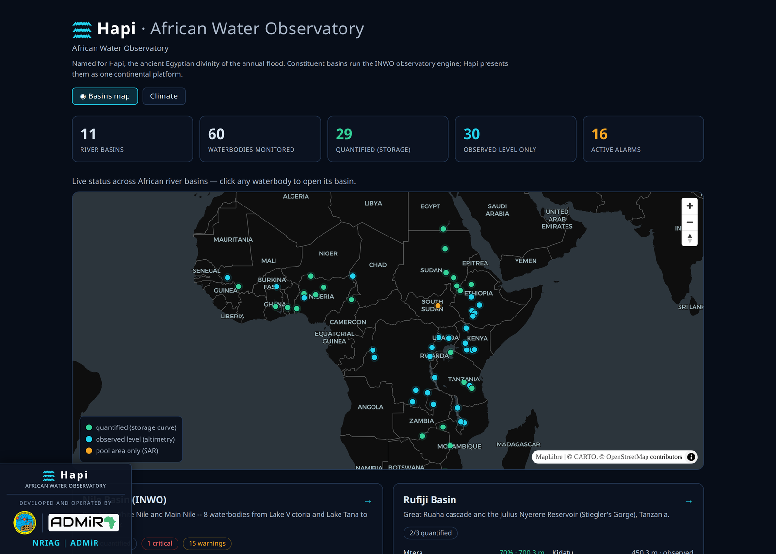
Hapi — named for the ancient Egyptian divinity of the annual Nile flood — is an open, satellite-driven water observatory for Africa. It monitors reservoirs, lakes and wetlands across eleven river basins (the Nile, Zambezi, Congo, Niger, Volta, Senegal, Orange, Lake Chad, the East African Rift, Limpopo and the Rufiji) using only public satellite missions and open reference datasets — no private data, no ground gauges required.
Africa carries much of the world's climate-related water risk in its river basins, yet is among the most sparsely gauged regions on Earth. Hapi closes that information gap from space, turning free Earth-observation data into continuous, objective, auditable measurements of how much water each system holds, how its surface is changing, how clean it is, and the climate that drives it.
At a glance: 11 river basins, 60 waterbodies monitored, 29 reservoirs quantified, record span 2002-2026, 100% open data and code.
What Hapi monitors:
- Water quantity and storage — reservoir level, storage volume and percent-filled by hypsometric inversion from radar altimetry and water-extent imagery; 29 reservoirs quantified, including ungauged, newly filled dams (GERD, Julius Nyerere) with a DEM-optical-SAR method needing no gauge.
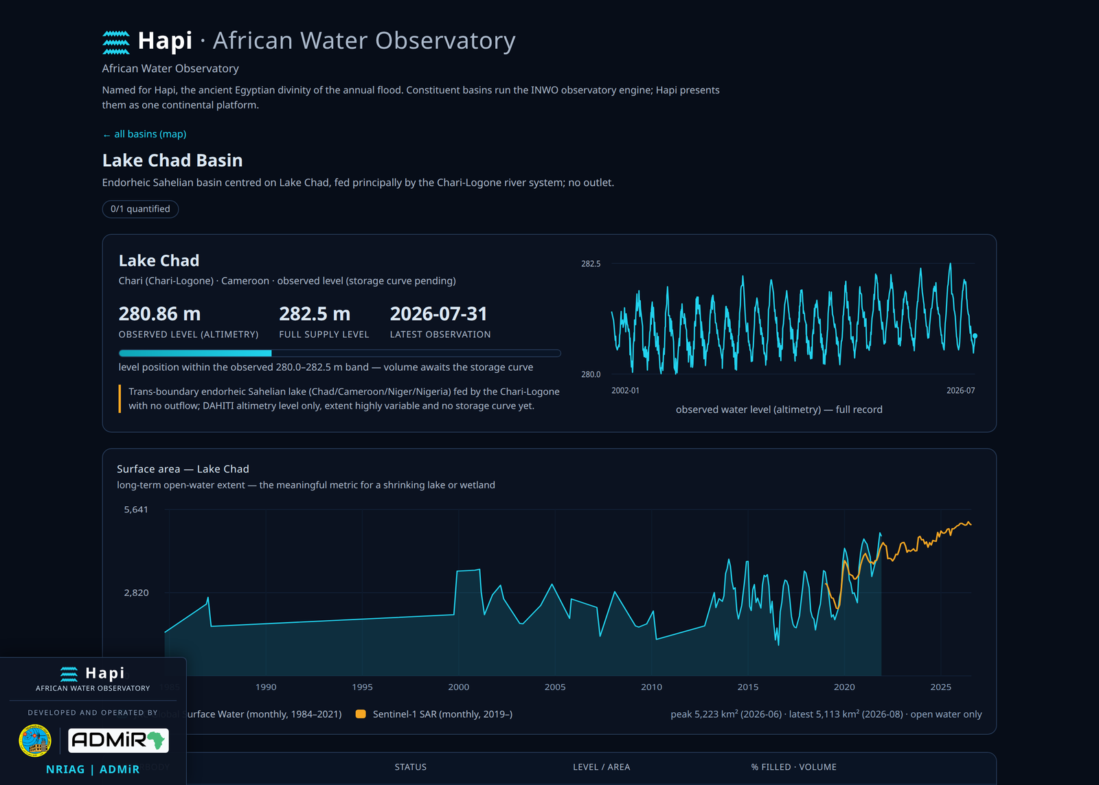
- Surface and flood extent — all-weather Sentinel-1 radar plus optical imagery track open-water and inundation area for every waterbody, back to 1984 via the long-term surface-water record — the meaningful signal for shrinking lakes (Lake Chad) and flood-pulse wetlands (the Sudd).
- Water quality — Sentinel-2 indices for chlorophyll/algal-bloom, turbidity and floating vegetation, with sediment-screening and localized hotspot detection.
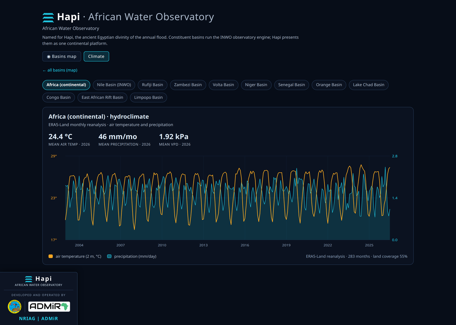
- Terrestrial water storage and climate — GRACE/GRACE-FO gravimetry for basin-scale total water storage, and ERA5-Land reanalysis for per-basin and continental temperature, precipitation and evaporation (2003-2026).
Why it matters: Hapi contributes the water-systems component of Africa's disaster-risk and adaptation agenda, aligned with the Sendai Framework for Disaster Risk Reduction, the WMO Early Warnings for All initiative, and SDGs 6 (water) and 13 (climate action) — supporting drought and reservoir management, flood and wetland monitoring, trans-boundary water diplomacy, and climate-change adaptation. Hapi today is a monitoring and situational-awareness platform; turning this backbone into operational, forecast-based warnings is the next step on the roadmap.
How it works: Hapi fuses open satellite streams — Sentinel-1 SAR, Sentinel-2/Landsat, DAHITI altimetry, JRC Global Surface Water, GRACE/GRACE-FO, ERA5-Land, SRTM DEM — into one coherent, per-waterbody picture through a basin-agnostic engine and a single continental portal. It is built on a data-integrity discipline: no synthetic data, honest gaps, explicit uncertainty, full provenance, versioned calibration and end-to-end reproducibility.
Developed and operated by the National Research Institute of Astronomy and Geophysics (NRIAG), Egypt, and ADMiR, building on open data from ESA/Copernicus, NASA/USGS, DGFI-TUM (DAHITI), the EC Joint Research Centre, ECMWF/C3S and NASA PO.DAAC.